Robust Environmental Mapping by Mobile Sensor Networks
Hyongju Park · Jinsun Liu · Matthew Johnson-Roberson · Ram Vasudevan
TL;DR
A Bayesian, decentralized deployment method lets robot teams keep mapping an environment accurately even when some robots' sensors fail.
BRIEF
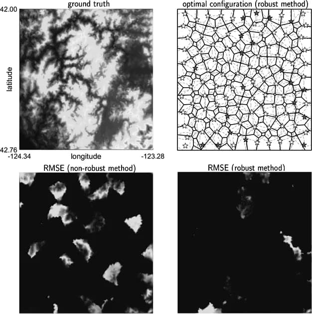
Teams of cheap mobile robots can map things like chemical plumes, fire risk, or terrain elevation, but the sensors often fail, and existing decentralized methods then stop converging to the true map. This work uses a Bayesian approach in which a Voronoi-style partition assigns each region to at least one robot. The robots then move on their own to maximize the chance that at least one of them detects every target in its region, even if some sensors fail. Simulations show better robustness than existing techniques.
Abstract
Constructing a spatial map of environmental parameters is a crucial step to preventing hazardous chemical leakages, forest fires, or while estimating a spatially distributed physical quantities such as terrain elevation. Although prior methods can do such mapping tasks efficiently via dispatching a group of autonomous agents, they are unable to ensure satisfactory convergence to the underlying ground truth distribution in a decentralized manner when any of the agents fail. Since the types of agents utilized to perform such mapping are typically inexpensive and prone to failure, this results in poor overall mapping performance in real-world applications, which can in certain cases endanger human safety. This paper presents a Bayesian approach for robust spatial mapping of environmental parameters by deploying a group of mobile robots capable of ad-hoc communication equipped with short-range sensors in the presence of hardware failures. Our approach first utilizes a variant of the Voronoi diagram to partition the region to be mapped into disjoint regions that are each associated with at least one robot. These robots are then deployed in a decentralized manner to maximize the likelihood that at least one robot detects every target in their associated region despite a non-zero probability of failure. A suite of simulation results is presented to demonstrate the effectiveness and robustness of the proposed method when compared to existing techniques.